|
For this trip we are equipped with Satellite phone, SPOT and a Personal Locator Beacon (PLB).
This year's trip will be divided into two parts.
Initially Philip Schubert and I will be visiting an area neither of us have seen before. If all goes as planned during this phase, we will then be returning to Hubbard Mountain where last year we installed a plaque commemorating a turning point in the ill-fated 1903 expedition led by Leonidas Hubbard. Mosts wilderness canoeists will have heard of the Hubbard Expedition. Great Heart by James West Davidson and John Rugge provides one of the best accounts. You can see some of our previous trips here
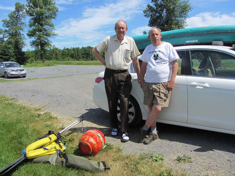
June 23, on his way to Labrador, Philip dropped off gear, including paddles, PFD and food
In 2003, the centennial of Hubbard's trip, Troy M. Gipps, Jim Niedbalski, Brad Bassi and Caroline Scully retraced Hubbard's route but deviated in one section. On their website http://www.wildernesscanoe.org/hubbardexpedition.htm they explain: "Hope Lake (we left the 1903 route here by portaging out of the west end of Hope Lake to avoid the very long portages to Disappointment Lake and Windbound Lake) (1 day)"
This year, Philip, an enthusiastic hiker, plans to walk the nearly 40 km over part of "the long portage", beginning at a point on the Orma Road.
We know that the first kilometre or two of Philip's route is
passable because we hiked in that far last year
Based on information gleaned from our good friend Google Earth as well as old topographical maps we assume Philip will face swamps and bogs on his route. Assuming he eventually emerges along the northwest shore of Disappointment lake, I will meet him with a canoe and we will make our way east along the lake and then into Hope Lake.
A float plane is supposed to retrieve us at the east end of Hope Lake and fly us to Happy Valley Goose Bay. Then we will pick up my vehicle and head for Windbound Lake where we begin phase II of our trip: a maintenance call on Hubbard Mountain.
Last year we hauled a granite plaque to the top of the mountain and using special glue we had brought along for the purpose, attached it to a large boulder. The plaque commemorates the turning point in Hubbard's expedition.
We had no idea what we would discover atop the mountain and even though we did our best in the circumstances we were never comfortable with the way we left things. The most troubling thing was the potential for water to enter crevices in the boulder and crack the plaque. Before leaving Labrador we made plans with a geologist working nearby with a helicopter, to land on the mountain and inject some caulking into strategic places, but that didn't work out.
If you have questions or want to get a message to either Philip or me please email Silvia Schaerer who will be in regular with us. Silvia will also be receiving our precise position each evening which we will send with SPOT and she will post this on our website.
Follow the trip, this page will be updated regularly:
June 28, 2012
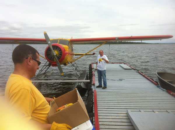
Plan changed. I drove to Baie Comeau today with a tandem canoe and my solo. I'll meet Philip in Churchill Falls tomorrow night. Sat night or Sun morning we are scheduled to fly from the Otter Lake seaplane base to the west end of Disappointment Lake. We plan to strap a tandem canoe to a 1940s vintage Beaver plane. Philip and me plus a small amount of gear will max out the plane's capacity.
Sent from a mobile device
June 29, 2012
Met up with Philip in Churchill Falls. He's in top shape and ready for action. We unloaded all equipment we shouldn't need for the first phase of our trip and stored it at a friend of Philip's.
Sent from a mobile device
June 30, 2012
Had a leisurely breakfast at the hotel in Churchill Falls and drove to the seaplane base at HVGB. Storms in the area have kept us on "weather hold."
We left the canoe with the plane and will try again tomorrow (Sunday) a.m.
Sent from a mobile device
July 1, 2012 Happy Canada Day!
Interesting breakfast, at the B&B in Happy Valley, with an adventurous couple from Belgium.
We're scheduled to take off at 11:30 but the weather looks dicey...
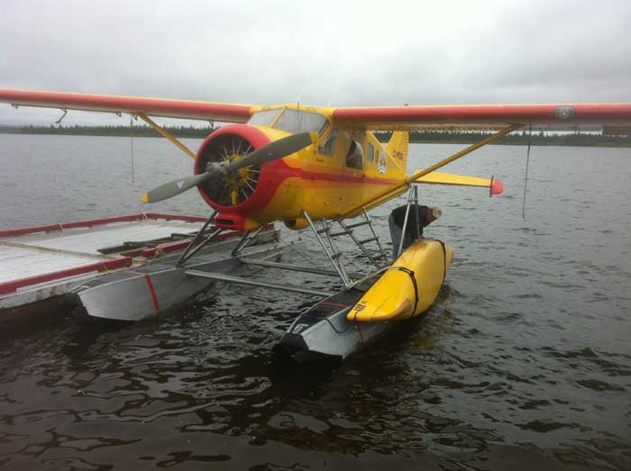
Finally got the canoe tied onto the Beaver just before taking
off for the west end of Disappointment Lake
July 1, 2012 5 p.m.
Latitude: 53.80846
Longitude: -62.66977
... Observed snow on our low level flight through the mountains. Put in Lake Disappointment from the pontoon of the plane, in the middle of the lake. Set up camp on a nearby point about 20 min later and enjoyed a leisurely supper on a rock looking out at the lake. Depending on weather well stay here for a while as a base camp.
July 2, 2012
Latitude: 53.80816
Longitude: -62.66965
Had a leisurely breakfast 6: 30 a.m., waited for a shower to end then paddled to the west end of Disappointment Lake near Philips food cache. We stopped back at our camp site for lunch then paddled east, on the north side of Lake Disappointment, looking for a possible beginning of the Long Portage which we may in fact have located. Supper back at our camp site. We are sharing the lake with several osprey a pair of loons and common terns. Tomorrow, weather permitting, we paddle east towards Hope Lake.
July 3, 2012
Latitude: 53.78693
Longitude: -62.46832
We paddled east on Disappointment Lake and found the two rivers/streams that connect to Hope Lake. We chose the most easterly one and then had a few hours running and lining through moving water. We saw several beautiful waterfalls. 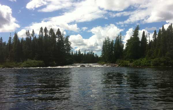
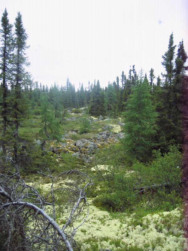
The unnamed river/stream connecting
Disappointment Lake with Hope Lake
Our camp site tonight has a sandy beach, a rocky area for dining and a semi sheltered area with caribou moss to pitch our tent on. We had a swim after supper. Tomorrow we may climb the mountain used to by the Hubbard expedition to find their way. We will stay at this base camp at least one more night.
July 4, 2012
Same location as yesterday.
Random wind gusts made it unsafe to cross the bay to the mountain, instead we focused on a site Hubbard might have camped at. We decided he had not. We were back at our Hope Lake base camp for lunch and spent the rest of the day laying on our beach and swimming, a pair of loons spent the day observing us. Our itinerary now is weather dependent; the weather has been very hard to read.
July 5, 2012
Latitude: 53.78732
Longitude: :-62.28549
We reached the east end of Hope Lake and set up our tents just ahead of a light rain. Weather cleared after a few hours and we had a chance to explore after a pleasant supper on a sandy beach. We found the Hubbard portage route and followed it to an unnamed lake upstream from Hope lake. On the way back to our campsite we noticed snow along the rocks just above the water.
July 6, 2012
Same location as yesterday.
Our campsite is surrounded by mountains but we managed to reach our float plane pilot. He says he will pick us up at 7:00 p.m. tonight.
At 7:20 p.m. we hear a Beaver flying over and a plane begins to circle as though searching for us. Our bright yellow 16ft canoe is overturned along the beach and our colourful tents and camping gear are strung out over anther 16 ft or so but Philip recalls an earlier trip when another pilot was ready to return home without landing because he was invisible from the air.
Just to be safe I begin waving my PFD and Philip fires off a flare. The plane climbs and flies off to the west. Then he returns and circles us. This time Philip used a hand held flare and also launched every other flare he had. It was a great show, worthy of Canada Day, but the Beaver climbed and flew east. We spent the next hour alternating between broken calls to the seaplane base and asking each other how the pilot could have missed us. I reached Silvia who also called the seaplane base, they told her there had been a problem locating us so she emailed our coordinates.
Eventually we reached the pilot ...
July 7, 2012
Latitude: 53.29967
Longitude: -60.30878
... It seems there were dangerous wind shear conditions that prevented any chance of landing. "I wondered why you boys were setting off all the flares. I had no trouble seeing you." our pilot chuckled. We're scheduled now for early this morning.
The plane was able to pick us up and we are now back in Happy Valley Goose Bay.
July 9, 2012
We spent the weekend in HVGB being tourists and visiting with friends.
Today we are driving to Churchill Falls. Tomorrow we begin phase II of our trip: the maintenance call on Hubbard Mountain.
July 9, 2012 10 p.m.
Latitude: 53.99251
Longitude: -62.98199
We are no beside the Orma Rd, close to Windbound Lake. We will begin paddling tomorrow if the weather is good enough. Unfortunately, there is quite a bit of rain/wind in the forecast which may delay our trip for a few days.
July 12, 2012
Philip and I have returned home much earlier than planned. Due to poor weather it was decided to try another plan for Mount Hubbard. More on this as things develop.
Update
Our "plan B" was a long shot. Before leaving Churchill Falls Philip and I decided to search for Scott Macdonald a man we had met on the Orma Road while we were headed north and he was returning to Churchill Falls.. During our earlier encounter we learned that Scott was interested in the Hubbard expedition and familiar with some of Philip's earlier trips. He regularly inspects the dikes that surround the Smallwood Reservoir using a pick up truck for some inspection trips. Other days he patrols by helicopter.
Churchill Falls is a friendly place and although we had no idea where Scott lived and couldn't find him in the phone book, it wasn't long before we were standing in his apartment, pitching a plan that would have him check our plaque, during one of his helicopter runs.
I've written about Nalcor in an earlier account on this website. From what I've seen the company is very community-minded. Scott was optimistic that he could get permission to check the plaque.
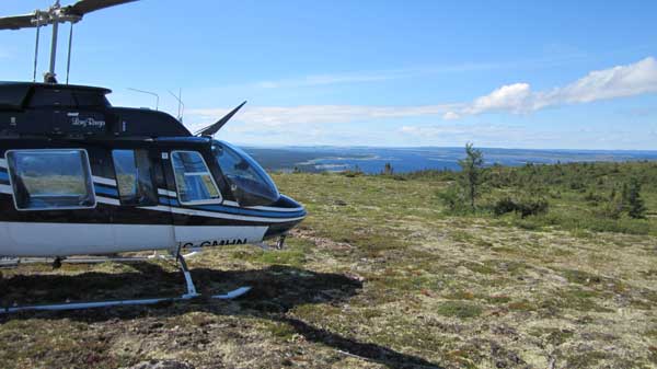
On Aug 8 2012 Scott landed on Hubbard's Mountain in this Bell Long Ranger:
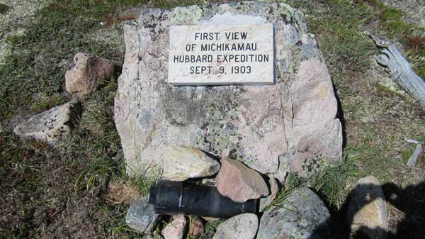
He sent me some great photos including this one showing the condition of the plaque and revealing some of the epoxy and caulking he applied to prevent water from getting between the rock and the plaque. Scott says there were already two names in the black ABS cannister in the cairn at the base of the rock: presumably helicopter pilots flying over. To learn about the rest of the contents of the cannister you are going to have to visit it.
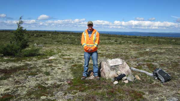
And here is Scott posing beside his handiwork.
|