| Home | About Us | Get Involved | Equipment | Food | Links | VKH Weather | Resources | FAQ |
| |
| Help Sponsor |
| Previous Years' Trips |
| Contact |
Robert's 2007 Labrador Trip to the Hubbard Rock
|
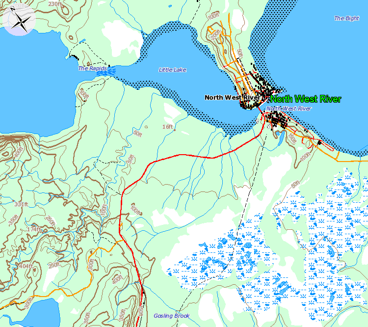
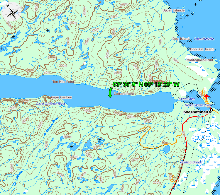
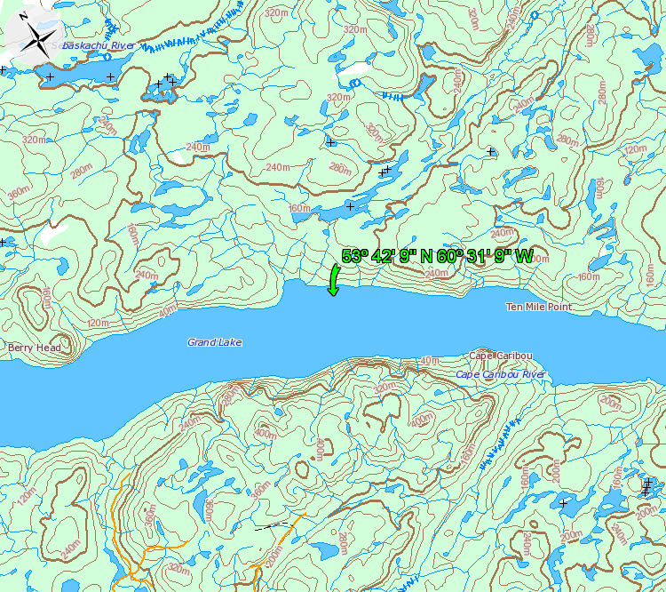
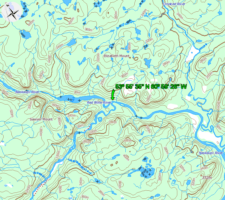
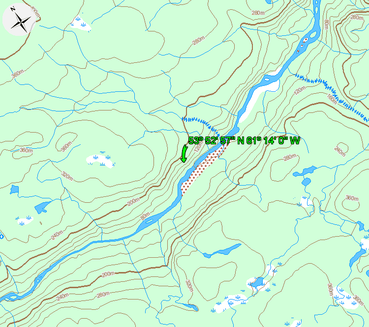
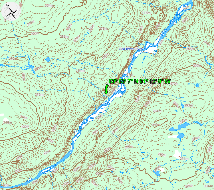
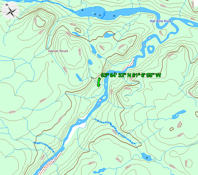
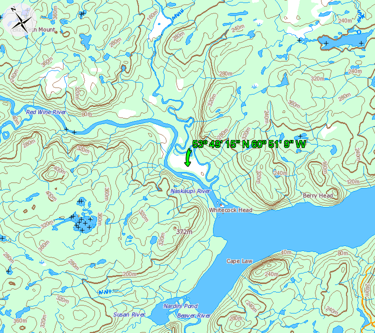
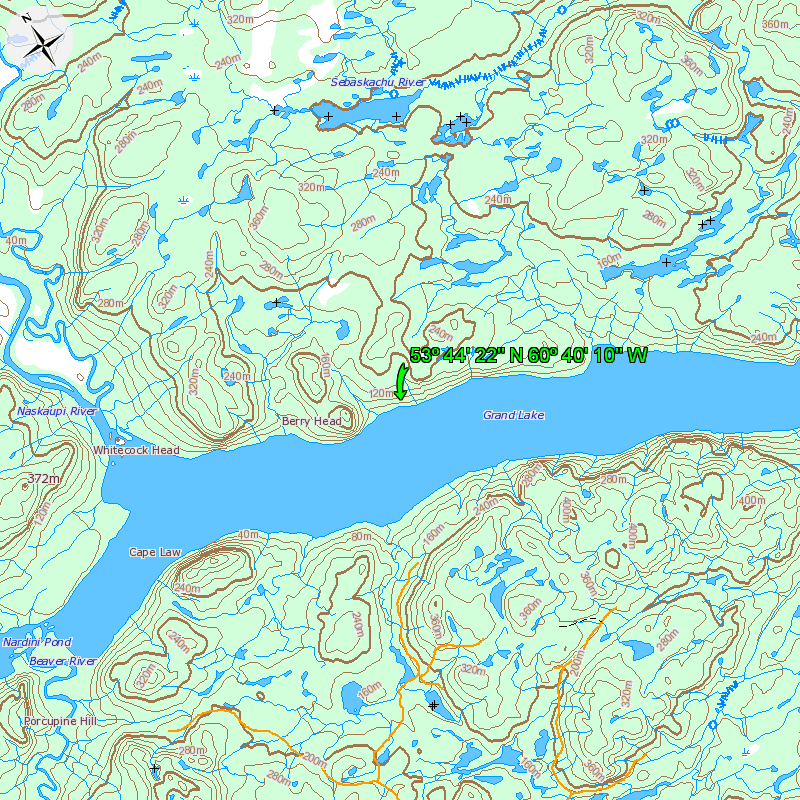
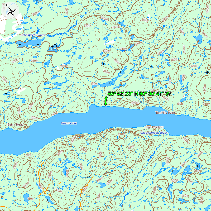
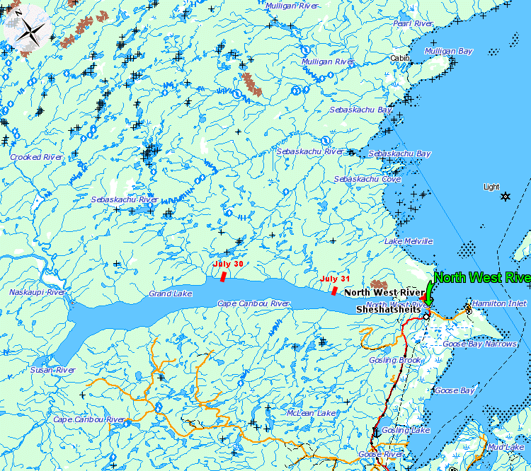
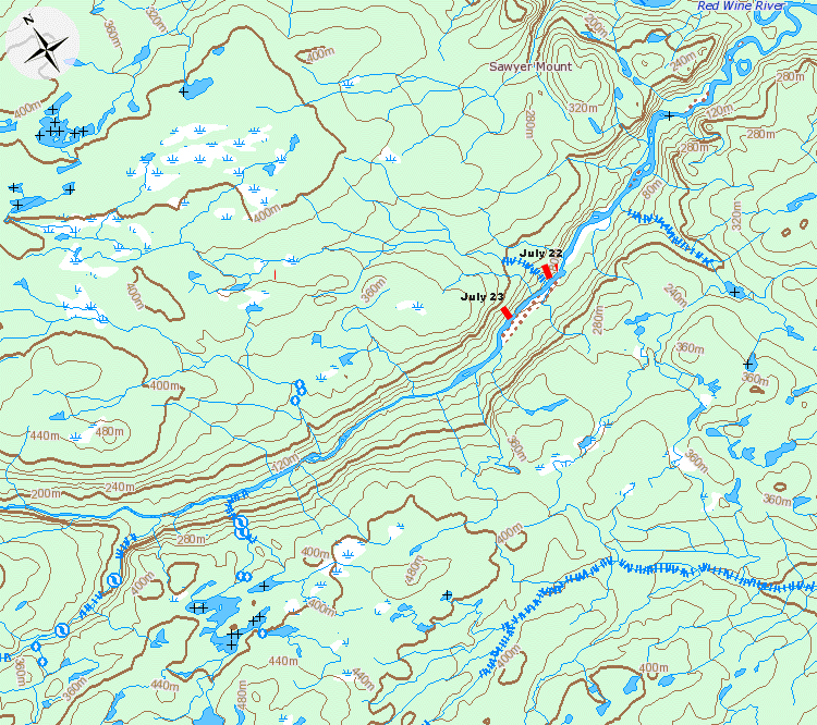
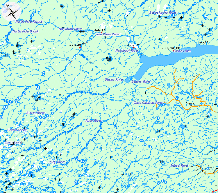
Where is Robert? This site has been set up to keep family and friends up to date about where I am and how my trip to the Hubbard Rock trip is progressing. At the bottom of this page, thanks to Silvias efforts, you will be able to click on a map showing my most recent campsite and read my latest observations. Why a solo trip? Thats easier to explain than the question I hear more often: why go there at all? But more on that later. This trip didnt begin as a solo it just ended up that way. Several people were scheduled to join me and then had to cancel. I felt the trip was inappropriate for a couple of others who wanted to come. Solo trips have a unique appeal which Im looking forward to in this case but Im not one of those zealous soloists who believe its the only way to go. Satellite phone service, especially in river valleys, is problematic so there will be days without any updates. Ive been a long-time Globalstar customer but their satellite network has become increasingly unreliable. I only discovered how bad things were, during a couple of canoe trips in northern Ontario last month when service was generally unavailable. Im therefore grateful to Adam Lewis, Qaujimautik Systems Inc., who managed to get me an Irridium sat phone on short notice. I will still have the Globlstar as a backup and I will also be carrying a personal locator beacon (PLB) purchased previously from Adam. A detailed plan has been filed for this trip with the Canadian Beacon Registry. As family and friends know, Ive been canoeing in the wilderness for decades and have paddled in Labrador (including Grand Lake and the Naskaupi river) before. Some of what I will be doing this time, should therefore be familiar. This is however the longest solo trip I have attempted and it involves a mountain climb as well as a 20km hike through some rough terrain. And Im not getting any younger, so this will be a challenging adventure. The plan: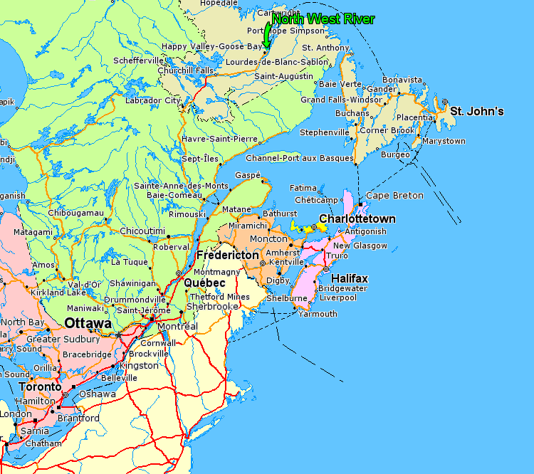 I plan to leave Vankleek Hill July 12 and reach Baie-Comeau, Que., the first night. I should arrive in Labrador City July 13 and Happy Valley-Goose Bay July 14. Its a beautiful part of the world. As veteran New Brunswick canoeist and fellow Labrador-enthusiast Rory Matchett wrote me recently: That country keeps tugging at your heart to go back again. That fact and the compelling pull of the Hubbard legend are the only answers I can come up with for those of you who have so many times asked: why are you doing this? If things work out as planned I should reach the remote Susan River and the rock where Leonidas Hubbard died. I may also be able to bring back the first photos of the area following the forest fire that went through in 2003. Weather permitting, I should put my canoe in the water at North West River July 15. Ive allowed 30 days to explore the area but as with any wilderness trip Im equipped with supplies for a much longer period to allow for adversity. Philip Schuberts website provides a detailed account of his 2003 trip to the rock as well as some excellent historical and geographical perspective: http://magma.ca/~philip18/Hubbard-Rock.html Until he was air lifted from the area due to the fire, Philip managed to take what might be the last photos of the rock before the intense burn changed the way things originally looked back in 1903. I want to thank Philip for his generous help with my trip planning. Photos of the trip Where I am on: August 1st, 2007Back in North West River July 31, 2007 Slowed by showers and thunder storms and finally stopped by a major thunderstorm and headwind. 5:00PM - N53-36.915 W60-19.285 July 30, 2007 I have been seeing signs of wolves along the Red Wine and Naskaupi. Early this morning they serenaded me while I loaded the canoe. Later in the day I drifted in on a sow with two cubs and I actually heard them orally communicating, something I have never heard bears do before. 8:30PM - N53-42.960 W60-31.928 July 27, 2007 Half of the food for the hike was stored in a bear1-vault left on the ground. The other half was in a bright pink drybag suspended from a tree. Last night the drybag disappeared. More on this later. I've pulled back to the Naskaupi River. Really memorable four hour return trip down the Red Wine; just about an hour ahead of a nasty thunder storm. July 26, 2007 Ominous clouds followed by distant thunder and a few more clouds, overall a hot pleasant day but one better suited to local exploring than mountain climbing. I am now at the edge of the time allotment (19 days), in my trip plan, for the hike and return to North West River by August 15th. July 25, 2007 I probably should have traveled today but as soon as I saw a few thunder-heads early this morning I decided to be patient and wait for the best possible opportunity to climb the mountain. The mountain appears to be the biggest challenge of the trip and if possible I want to avoid getting caught in a thunderstorm during my attempt to climb it. July 24, 2007 Stayed here due to rain. July 23, 2007 Reached the take out point for the hike. There are numerous heavily travelled animal trials that intersect throughout the area. Tomorrow is a rest and equipment maintenance day. 8:30PM - N53-52.574 W61-14.080 July 22, 2007 This was a long, hard day, but I am getting closer 8:30PM - N53-52.766 W61-12.951 July 21, 2007 I found a good campsite on an isolated sand dune surrounded by small bolders. I decided to remain here in the hope that the weather will improve. July 20, 2007 A gorges day on the Red Wine, a pretty river that relatively few paddlers have ever seen. 4:30PM - N53-54.326 W61-06.557 July 19, 2007 Stayed around the cabin for the day, leaving early tomorrow morning. July 18, 2007 Reached the Red Wine River this afternoon. Water levels of both rivers are a bit higher and the current is stronger than expected. I am not sure what effect, if any, this will have on my efforts to line the canoe up the Red Wine River. 5PM - N53-55.34 W60-59.26, Louie's cabin. July 17, 2007 Reached the Naskaupi River around 10:30AM, Grand Lake was like glass this morning; stopped early due to more thunder storms 5PM - N53-49.153 W60-51.994 July 16, 2007 Rain & thunder storms during the day 6PM - N53-44-228 W60-40.102 Excellent paddling conditions, went further than planned for day one. Now (11AM, day two) stopped by thunder and lightening 11AM - N53-42.231 W60-30.415 July 15, 2007 North West River, Labrador The big picture from July 27 from July 22 to July 26, 2007 from July 18 to July 21, 2007 from July 15 to July 17, 2007 |