|
Watch this page for daily updates
Reg & Robert approximately 30 days following the historic river and some of the portages used by the Hubbard & Wallace expeditions in 1905, as well as the Innu over the centuries.
Start point Orma Lake, 54° 06'42.49"N 63° 08'50.00"W, End point Seal Lake, 54° 18'38.59"N 61° 25'49.22"W with the possibility of extending the trip to North West River.
Click on image for a larger view

June 27, 2013
Robert and Reg left Vankleek Hill early in the morning, spending their first night in Baie-Comeau
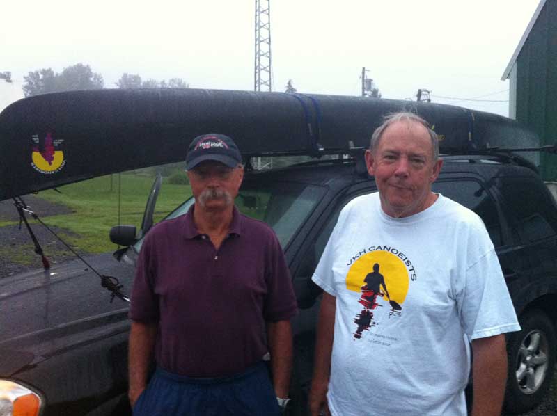
Reg and Robert ready for their adventure
June 28, 2013
Robert and Reg left Baie-Comeau in the early morning heading for Churchill Falls spending their night at the only Inn there.
Their trip is being delayed unexpectedly by a forest fire in Wabush, near Labrador City. They spent the night camped outside Labrador City. The Trans Labrador Highway has been closed by police.
June 29, 2013
This moringing Robert and Reg are part of a convoy waiting and hoping for an opening in the fire, so they can continue on to Churchill Falls. Part of Wabush has been evacuated.
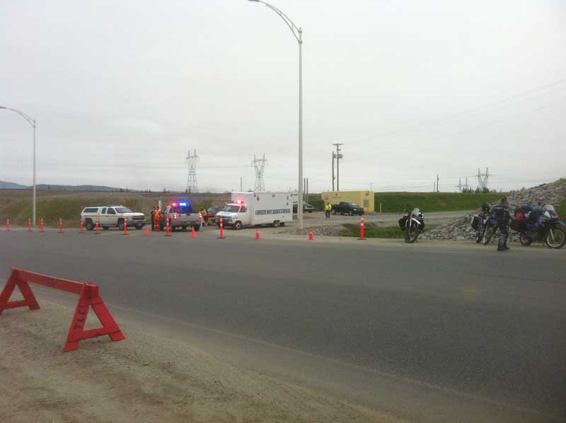
At Labrador City Trans-Lab Highway closed this morning at 7:45 am
June 29, 2013 - evening
Latitude: 54.11860N
Longitude: 63.07681W
Dropped at the wildlife cabin around 6pm. Paddled across Orma Lake and into the stream connecting to Marie Lake, finished around 8pm. Smoke from Labrador City fire visible. Rain at night.
June 30, 2013
Latitude: 54.10902N
Longitude: -63.03415W
Delayed by rain. At 10am began lining and portaging around and over nasty boulders. Reached camp site on west end of Marie Lake around 2pm. Setup tent in the rain.
July 1, 2013 same location as June 30
Latitude: 54.10902N
Longitude: -63.03415W
Stopped by rain and high winds. Eating well, catching up on sleep.
July 2, 2013
A quick run up Marie Lake. We wound our way through several islands before encountering numerous rapids that required lining. Camped for the night below Isabella Falls.
July 3, 2013
Latitude: 54.15051N
Longitude: -62.85089W
Leisurely paddle and lining from Isabella Falls, which is hardly a falls, to Gertrud Falls which is spectacular. Nice weather, very high winds.
July 4, 2013
Latitude: 54.17160N
Longitude: -62.80042W
Began Gertrud Falls portage, down a staircase slot, very technical portage, took almost 3 hours. Began Jobs portage around Maid Marian Falls gorge, about 2:30pm.
July 5, 2013
Latitude: 54.18531N
Longitude: -62.76776W
Portage to Razor Lake. Camped tonight on a vast area of caribou moss about 500m from Whale Pond which actually appears to be a large lake.
July 6, 2013
Latitude: 54.20713N
Longitude: -62.73865W
Portage into Whale Pond then Angle Pont eventually found the route to Mina Lake. It could be challenging, there is a steep climb at the beginning. Rain tonight
July 7, 2013
Latitude: 54.21909N
Longitude: -62.72784W
Portage to Mina Lake went well, big uphill climb at the beginning. Now we have a puzzle: Who littered the trail? Reg found a clear glass Patent medicine bottle in a burned out area. On the front of the bottle Davis is moulded in the glass. One side has the word painkiller the other side sais vegetable. So, who threw this bottle away: Job Chapies? George Elson? Mina
Earlier on this trip we found other items along the way but nothing as intriguing as this one.
July 8, 2013
Latitude: 54.22110N
Longitude: -62.70538W
Ideal day, high wind, alternating sun and rain continues, portage from Mina Lake to Unnamed Lake about 1.25km east. Beautiful campsite sheltered from wind, numerous Crown- and White-throated sparrows throughout the area.
July 9, 2013
Latitude: 54.22692N
Longitude: -62.69116W
Slow progress due to a widespread burn area with bogs and blow-downs. We carried around three lakes where we had planned to paddle across but were stopped because the water levels were too low that meant the shore lines were hard to access.
July 10, 2013
Latitude: 54.23175N
Longitude: -62.67505W
Another slow day carrying through bun area. Just 500m left before we finis Jobs Portage and be on the Naskaupi river again.
July 11, 2013
Rain and high winds last night and today. Quiet day in the tent.
July 12, 2013
Latitude: 54.23523N
Longitude: -62.66568W
Finally back on the Naskaupi river around 10am. We did laundry at a beautiful camp site at the put-in and decided to stay for the day.
July 13, 2013
Latitude: 54.33622N
Longitude: -62.33963W
Today the river wound through rugged mountains and served up a set of rapids every few minutes. We lifted over scenic Halley McLean Falls and portaged around the iconic Hole in the Wall. We finally emerged from the massive burn area we've been traveling through since Angle Pond on Job's portage. This is a shallow river some places aren't deep enough for our canoe. One thing about the river that doesn't change, whenever you look ahead it's dropping.
July 14, 2013
Latitude: 54.39912N
Longitude: -62.11139W
For the past two days we have seen numerous waterfalls, mostly Merganzers and flightless Canada Geese. We are also seeing widely separated beaver lodges.
Today at 1:30pm we reached the Seal Rapids portage trail. Unfortunately a forest fire appeared to be crossing the river ahead of us, It maybe blocking our portage route. We will have to learn more about this fire before proceeding.
Apparently this fire had not been reported. If we cant learn anything further tonight we have to explore more tomorrow.
July 15, 2013
Landed in Happy Valley-Goose Bay
View Naskaupi Trip 2013 in a larger map
|